Fort Worth's Trinity Trails

Thursday, September 16, 2010

Trinity Trash Bash This Weekend!

This Saturday (September 18. 2010) is your chance to do your part to keeping the Trinity River (and Trails) beautiful during the T.R.E.E.S. (Trinity River Environment Education Society) Trinity Trash Bash!

TREES promotes river clean-ups throughout the Trinity River watershed (see their site for events throughout North Texas) and this weekend's cleanups involve areas near and along the Trinity Trails.

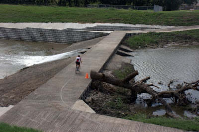
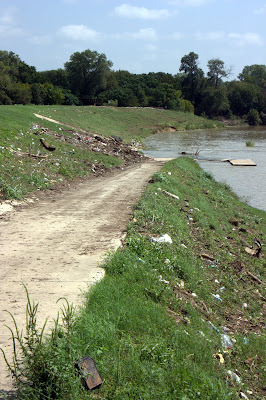
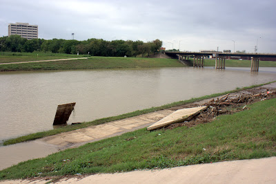
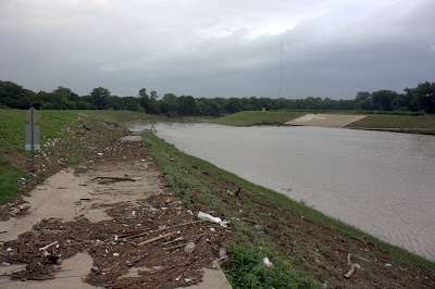
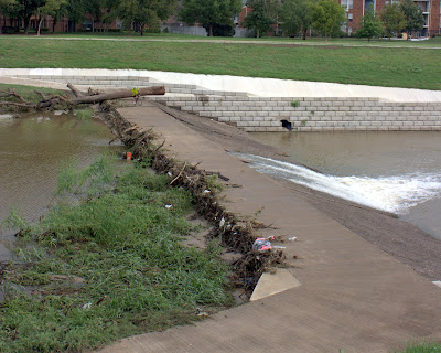
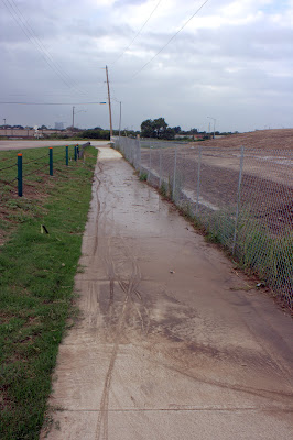
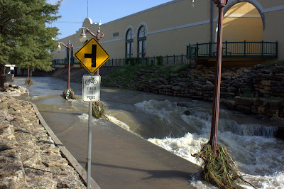
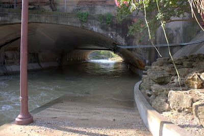
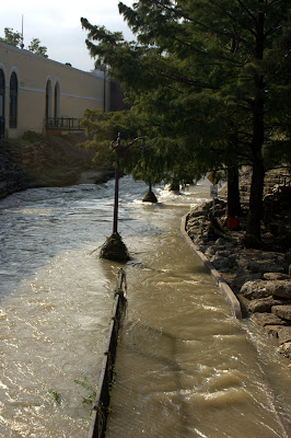
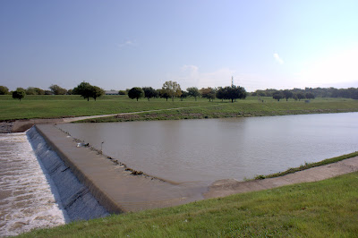
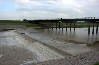
The river and trails could really use some help with litter clean-up after the recent storms.

The Fort Worth event is lead by the TRWD (Tarrant Regional Water District) and there is also an event in Benbrook.

You can register for the Fort Worth/TRWD Trash Bash on TRWD's website.  There are 7 primary clean-up areas and the Trash Bash Party site shown on this TRWD map.

From the TRWD site:
The 19th annual Trinity River Trash Bash will be held September 18, from 8:30 to 11:30 a.m. at various points along the Trinity River. 
All volunteers are invited to a party immediately following the cleanup at Rockwood Park in Fort Worth from 11:30 a.m. to 1:30 p.m. with food, prizes and entertainment by Radio Disney 620 AM. 
Cleanup kits will be available to volunteers the day of the event at one of the registration sites. Participants receive free T-shirts and are eligible for numerous prizes donated by sponsors.

Friday, September 10, 2010

Update: Trail Conditions After Storm

In the 24 hours since yesterdays post on Tropical Storm Hermine's effects on the Trinity Trails, 2 major clean-ups have taken place:

  • The large tree blocking the low water crossing at Bellaire and Southwest Blvd. (Hwy. 183) has been chainsawed and removed from the low water crossing:


Tree at low water crossing at Bellaire Dr.


  • And the thick layer of mud and debris at the Beach St (at I-30) near Gateway Park has been removed:


Ramp at low water crossing near Gateway Park.


Water still covers most of the low water crossings, especially those downstream from downtown, but the water will probably recede sometime this weekend.  Gateway Park has reopened.

It will probably take longer to get the Marine Creek section of the trails (near & under the Stockyards) cleaned of mud and debris since heavy equipment (front end loaders) can get onto that section of trail.  They'll be an update on that stretch of trail next week.

Thursday, September 9, 2010

Trinity Trails Closures After Hermine Storm

see also:  Update: Trail Conditions After Storm

After over 6 inches of rain Wednesday and Thursday from the remnants of Tropical Storm Hermine, all of the low water crossings of the Trinity Trails are under water. The water will soon go down, but there will some lasting effects to the trails. Mainly:
  • There is a great deal of debris and mud on the ramps to the low water crossing at Beach St. (near I-30) outside Gateway park. These ramps will be treacherous to runners and cyclists until the mud and debris is cleaned up. (As of this morning, all of Gateway Park was closed to the public because of high water and storm damage.)

Low water crossing at Beach St.; damaged FW Rowing Club dock.

Low water crossing at Beach St. (Gateway Park); much debris and thick mud.

  • There is a large tree blocking the low water crossing at Bellaire Drive and Southwest Blvd (Hwy. 183) that makes the trail all but impassable. As you can see in the photo it would be possible to carry a bike over the tree, but not easy. Runners/walkers might also want to avoid climbing over this large tree.

Tree over low water crossing at Bellaire Dr. & Southwest Blvd. (Hwy 183).


Tree over low water crossing at Bellaire Dr. & Southwest Blvd. (Hwy 183).


  • The trail detour near Northside Drive is very muddy in one area (as shown in a photo below) and completely covered by a large puddle in another, undoubtedly with mud underneath (not shown).

Along Northside Dr.


  • The trail along Marine Creek, through the Stockyards was completely under water this morning and, judging from past storms, there will be significant mud and debris that will make the Trail impassable until it is cleaned up. Low areas farther up the Marine Creek section of the Trail have probably suffered a similar fate.

Trail along Marine Creek; Fort Worth Stockyards.


Mud & water covered trail under Exchange St., Fort Worth Stockyards.


Trail underwater along Marine Creek, Fort Worth Stockyards.


  • The low water crossings by La Grave Field (first photo below) and the 4th St. Bridge (second photo below) were still underwater, but did not have any debris blocking the path or significant mud on the ramps; so they might be passable soon. The amount of mud on areas still underwater remains to be seen.

Low water crossing near La Grave Field.


Low water crossing at 4th St. bridge.

If you have any reports about Trinity Trail closures, detours, damage, etc; please let us know so we can share it with everyone: info@trinitytrails.org

Tropical Storm Hermine Remnants Effects Trinity Trails

With over 6 inches of rain in much of the Fort Worth area, the Trinity River has swollen to cover the low water crossings of the Trinity Trails.

Based on hydrologic data from the National Weather Service, the Trinity peaked at about 5 feet above normal flow levels at downtown Fort Worth.

Past experiences with high river levels indicates that low areas of the trails will be covered with debris.

A great blog post, with many good photos (including the one below), at the Durango Texas Blog, shows the effect of the Trinity River on the Trinity Trails at Gateway Park.


Remember, that the low water crossing icon on our interactive trails map indicates locations that will be impassable until river levels return to normal.

UPDATE:  We now have more complete coverage of the storm's effect on the Trinity Trails.

Friday, September 3, 2010

Crestline Rd. Closed at University

Not a big deal, really... but I'm hoping this is the sort of thing for which TrinityTrails.org will be useful.

I know that quite a few people (I used to be one of them) access Trinity Park and Trinity Trails through Will Rogers Memorial Center since there's a crosswalk from WRMC to Crestline at University Drive on the east side of Will Rogers.

It was reported to me today that Crestline is (and has been for a bit) completely closed at University for construction (burying of some pipes).

Here's a map of the area with routes and construction marked on the map.  The light blue line is the WRMC/Crestline route into Trinity Park.  The green line is one alternate route through the Botanic Gardens (although there is not signal for crossing University).  Click on the Caution Icon for a description; that's where the construction is.

The crosswalk across University from Will Rogers to Crestline now leads to a construction zone and closed road.

Again... not a big deal, but there will be a lot of construction and development in the coming years that will effect the Trinity Trails and I hope this can be a venue to keep everyone aware of the related changes.

We might hopefully even have advance notice sometimes!

If you, in your use of the Trinity Trails, discover a change to the trail network that might effect other users, please, let us know at info@trinitytrails.org.  Thanks!

UPDATE: Thanks to Tim for pointing out that the City announced this closure in advance in their City News.